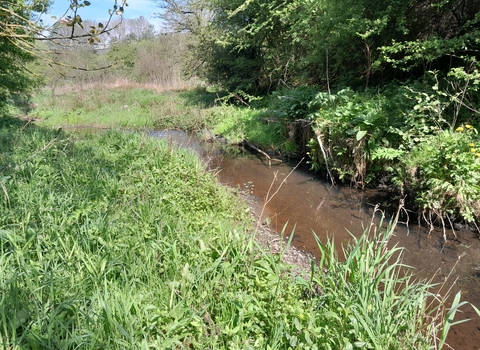
Trent ReNEW is a fixed term partnership project between the Environment Agency, Staffordshire Wildlife Trust and Support Staffordshire. The project will focus on two catchments within the Staffordshire Trent Valley landscape: The River Sow through Stafford and the Trent headwaters through Stoke-on-Trent. These rivers have been engineered to provide flood protection and other services. We are helping offset the necessary modifications by maximising the benefit of the stretches which can better resemble a natural water course.
The project aims to improve the biodiversity these two watercourses, through:
– Improving the dynamics of the water in the channel. We will change the structure of the river channel to include more natural features. The nature features will be chosen on a site-by-site basis to work with the shape of the channel and floodplain. Adding features, like riffles, will speed up water flows and add oxygen into the water, which is great for wildlife. Widening the channel, slows the flow which will improve how sediment is moved and deposited creating better quality habitats for wildlife.
– Reconnect the river to its floodplain. This will create a larger wetland area that is less likely to dry out during drought. Floodplains are key for the resilience of a watercourse providing natural services as well as important habitat.
– Create different habitats. In the river and across its floodplain we will create lots of different habitats which will support lots of different types of wildlife. By supporting wildlife at the bottom of the food chain we can restore the ecosystem upwards, and improve habitat for insects, fish, and birds.
– Protecting the river against pollution. Creating different wetlands, ponds and opportunities for species diversity in draining valley will help to filter pollution coming off the land before it enters the water.
All of the interventions being planned restore the river to increase the natural processes and benefits which we would expect in a healthy river. Nothing we are proposing will increase the risk of flooding to the local residences. Some of the actions may slightly lower the risk as we aim to hold the water in the floodplain where it belongs. All proposed changes are hydrologically modelled and subject to permits that consider the risk to infrastructure, people and the environment during and after completion.
Below you can read about what we are doing in each project area.
Ford Green Brook
SWT
Updates
07 November 2025
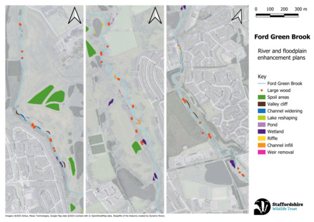
Exciting news! We're in the process of planning improvement works on Ford Green Brook and its floodplain.
Please find attached our works announcement which will be post physically around Ford Green Brook in the coming week as well as in local publications soon.
The Trent ReNEW enhancements will improve the biodiversity within the brook and floodplain. The changes will create new wetlands as well as variety in the current habitats which will support a greater array of species, without impacting flood risk in the surrounding area.
Channel infilling and widening will help reconnect the brook with its floodplain. The brook channel will be completely infilled at strategic locations. The infilling ‘resets’ the river, giving water a chance to form new paths with interesting meanders, shallows, and pools. This will increase the amount and variety of habitats.
Creating riffles is done through adding gravels into the channel. The shaping and mix of gravels hold back some water, creating a pool upstream with a shallow flow navigating its way over the gravels. Riffles oxygenate the water as the water bubbles over its surface supporting riffle beetles and breeding fish.
This work is in collaboration with Stoke-on-Trent City Council and the Environment Agency and builds on previous work which removed a weir in the channel.
All planned conservation work is subject to approvals and successful permits.
Planning Notice for Ford Green Brook
SWT Thea Margetts
Bucknall Park
SWT
Updates
15 January 2026
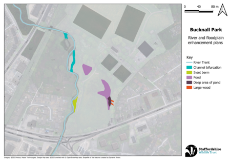
On 15 January 2026 the project team visited Bucknall park to review plans and make comments on the designs proposed by the contractors carrying out the work. More information will be coming soon.
All planned conservation work is subject to approvals and successful permits.
Staffordshire University Local Nature Reserve
SWT
Updates
05 July 2025
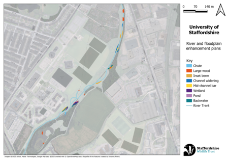
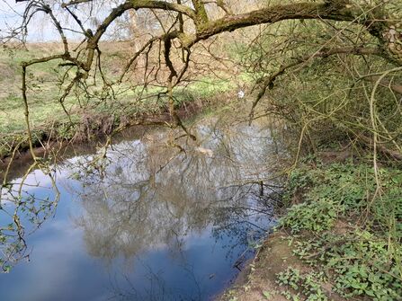
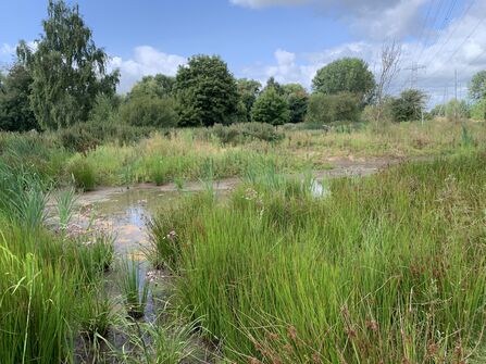
Adding further in-channel enhancements to the work done on the site through the SUNRISE Project in 2020 to re-naturalise the river. New proposals build on the previous interventions and include the creation of further backwaters, chutes, riffles, and the addition of large woody material into the floodplain. These will further add to the variety of habitat niches available to aquatic wildlife.
We have a set of proposed designs that are currently being investigated for their feasibility for deliver before being submitted for permitting.
All planned conservation work is subject to approvals and successful permits.
SWT Thea Margetts
Victoria Bunter
Healthy River Interventions
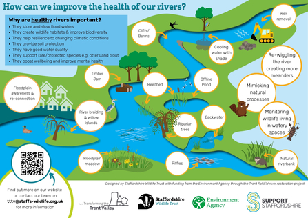
The following elements help inform our approach to creating a healthier river environment.
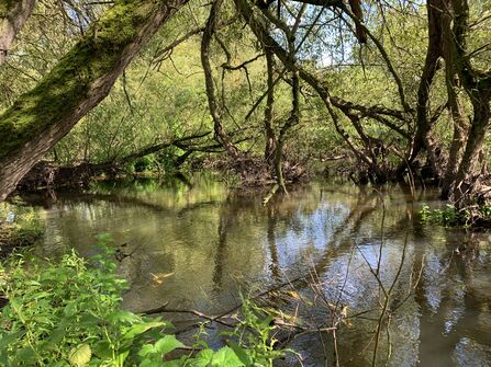
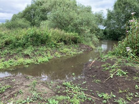
Backwater
Backwaters are parts of the river with little or no current. These can be a branch off from the main river channel or areas behind large obstructions in the channel. Natural backwaters in the floodplain can be created as the river changes path and the old channel stays connected but is now still.
Victoria Bunter
Victoria Bunter
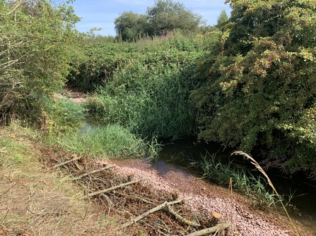
Berms
Berms, in the context of rivers, are a raised area along the bank formed by deposition. They are generally found on the inside of a bend where the river slows and can be made of different materials. These are dynamic mobile features shaped by the flow of water and can progress into stable benches or erode down to a bar.
Victoria Bunter
Chutes
Chutes are areas that direct a portion of the main river flow into the floodplain. They are created by lowering the bank and ground level – the gradient going from the river summer levels to surrounding ground level. This improves the function of the floodplain.
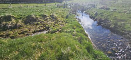
Photo thanks to Dynamic Rivers
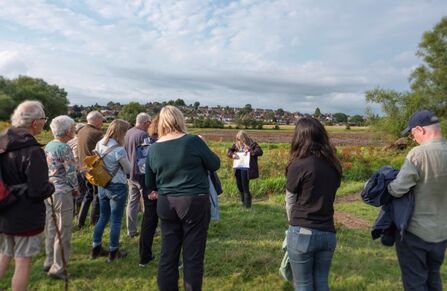
Floodplain awareness
Floodplain awareness is engaging with the public about river processes and floodplains to increase knowledge, understanding of changes and manage expectations. Engagement can cover a range of activities from meeting with local residents, posting on social media to creating and sharing educational resources.
Christine Harding
Floodplain meadows
Floodplain meadows are grasslands found on floodplains with grasses and wildflowers that are adapted to wetter occasionally flooded ground. They are a historical habitat type that is traditionally managed with cattle, which have disappeared in areas due to nutrient pollution and land use change.
Victoria Bunter
Reedbeds
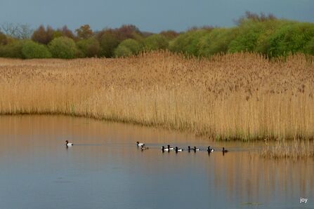
Reedbeds are transitional habitats dominated almost exclusively by common reed. They can be found in floodplains and at the edges of open water. Within a reedbed there can be a lot of microhabitats as the reeds transition from standing in water to damp and seasonally flooded areas.
Jane Ewing
Re-wiggling the river
The process of changing the river route to add in natural meanders. The scale of this action can depend on available land and land features. Rivers have been historically straightened for a variety of reasons, changing their dynamics and reducing the amount of wetland habitats.
Before re-wiggling by Calopteryx UAV Services
After re-wiggling by Calopteryx UAV Services
Riffles
Riffles are where rocks and pebbles on a shallow river bed create turbulence in the water. This feature looks like a bumpy water surface, sometimes with stones breaking the water surface. The feature changes with the flow of the water needing a swift current but relatively shallow depth.
Victoria Bunter
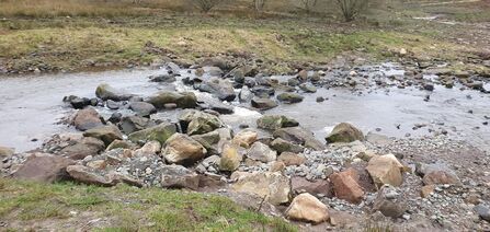
Photo thanks to Dynamic Rivers
Timber jams
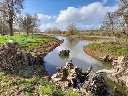
Timber jams are when woody material has fallen and become lodged across a river channel. These can be found anywhere along a river channel and can be man-made or naturally created out of a mix of woody material. The amount of material in the jam and locations can change with changing flows of water.
Victoria Bunter
Weir removal
Weirs are man-made structures used to control the flow of water by creating an overtopping dam. Removing a weir is taking out the artificial structure and returning the channel to a more natural flow dynamic. This action must be assessed on a case-by-case basis but can permanently improve a channel for nature.
Weir at Dovecliff by Victoria Bunter
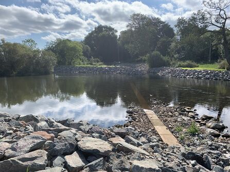
Removed weir at Dovecliff by Victoria Bunter
Willow islands
Willow trees that are found within the river channel with roots into the river bed. These can be seen in areas where willows are established along the riverbanks and generally on shallow riverbed areas. The islands change as the willow grows.
Nick Mott
SWT Kathryn Kavanagh

